Monitoring (semi-)natural ecosystems
Research
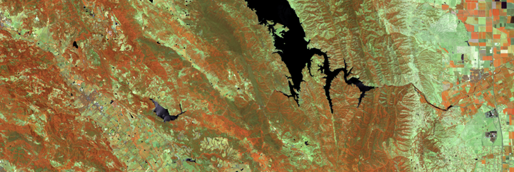
My research leverages Earth observation satellite time series to monitor (semi-)natural terrestrial ecosystems. I utilize imaging spectroscopy data from the most recent hyperspectral satellite missions, particularly the 👉EnMAP mission, alongside multispectral time series from the Landsat and Sentinel-2 archives to quantify diverse vegetation types, biophysical parameters, and vegetation conditions across time and space. By addressing pressing environmental issues such as woody plant encroachment, drought severity, wildfire impacts, and post-fire recovery, my work contributes to a better understanding of ecosystem patterns and processes, with the potential to inform sustainable management and conservation actions.
Selected publications
Okujeni, A., Kowalski, K., Lewińska, K.E., Schneidereit, S., & Hostert, P. (2024). Multidecadal grassland fractional cover time series retrieval for Germany from the Landsat and Sentinel-2 archives. Remote Sensing of Environment, 302, 113980. https://doi.org/10.1016/j.rse.2023.113980
Kowalski, K., Okujeni, A., Brell, M., & Hostert, P. (2022). Quantifying drought effects in Central European grasslands through regression-based unmixing of intra-annual Sentinel-2 time series. Remote Sensing of Environment, 268, 112781.https://doi.org/10.1016/j.rse.2021.112781
Okujeni, A., Jänicke, C., Cooper, S., Frantz, D., Hostert, P., Clark, M., Segl, K., & van der Linden, S. (2021). Multi-season unmixing of vegetation class fractions across diverse Californian ecoregions using simulated spaceborne imaging spectroscopy data. Remote Sensing of Environment. https://doi.org/10.1016/j.rse.2021.112558
Viana-Soto, A., Okujeni, A., Pflugmacher, D., García, M., Aguado, I., & Hostert, P. (2022). Quantifying post-fire shifts in woody-vegetation cover composition in Mediterranean pine forests using Landsat time series and regression-based unmixing. Remote Sensing of Environment, 281, 113239. https://doi.org/10.1016/j.rse.2022.113239
Cooper, S., Okujeni, A., Pflugmacher, D., van der Linden, S., & Hostert, P. (2021). Combining simulated hyperspectral EnMAP and Landsat time series for forest aboveground biomass mapping. International Journal of Applied Earth Observation and Geoinformation, 98, 102307. https://doi.org/10.1016/j.jag.2021.102307
Suess, S., van der Linden, S., Okujeni, A., Griffiths, P., Leitão, P.J., Schwieder, M., & Hostert, P. (2018). Characterizing 32 years of shrub cover dynamics in southern Portugal using annual Landsat composites and machine learning regression modeling. Remote Sensing of Environment, 219, 353-364. https://doi.org/10.1016/j.rse.2018.10.004